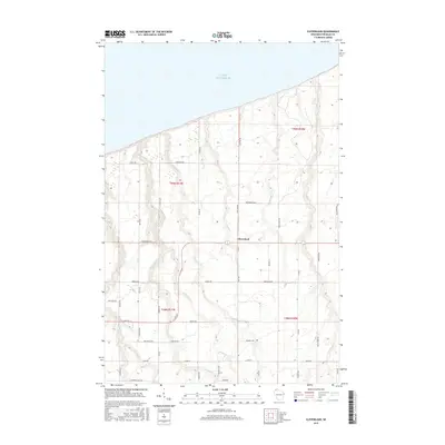
2015 Map of Cloverland
USGS Topo · Published 2015About this map
Lake Superior defines the northern coastline of this Douglas County landscape, where the settlement of Cloverland serves as a central point for the surrounding rural road network. The terrain is characterized by a series of parallel drainage systems, including Pearson Cr, Haukkala Cr, and Nelson Cr, which flow northward toward the lake through a patchwork of woodlands and clearings. Historically significant for its Scandinavian heritage, the area's roads often carry family names such as Pellman Loop, Jarvi Rd, and Haukkila Rd, providing vital clues for genealogists tracing local land ownership. Significant local infrastructure is noted through routes like E State Rd 13 and specialized corridors such as Snowmobile Aly, reflecting the region's adaptation to both commercial transit and seasonal recreation.
Find a feature on this map
51 named features on this map. Tap any name to fly to it.
Don’t see what you’re looking for? This feature index may not catch every label — zoom into the map to look around manually.
Map Details
Editions of this 2015 Cloverland Map
This is the sole edition of this map. No revisions or reprints were ever made.
Other maps of this area

1947 · Brule
USGS Topo · 1:48,000

1949 · Poplar
USGS Topo · 1:48,000

1953 · Ashland
USGS Topo · 1:250,000

1954 · Lake Nebagamon
USGS Topo · 1:24,000

1954 · Poplar NE
USGS Topo · 1:24,000

1954 · Poplar
USGS Topo · 1:24,000

1954 · Cloverland
USGS Topo · 1:24,000

1958 · Ashland
USGS Topo · 1:250,000
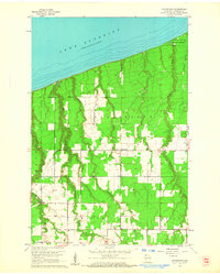
1961 · Cloverland
USGS Topo · 1:24,000
1961 · Lake Nebagamon
USGS Topo · 1:24,000