
1954 Map of Cloverland
USGS Topo · Published 1955About this map
The south shore of Lake Superior dominates this mid-century survey of Douglas County, where the terrain is defined by a series of parallel watercourses flowing north toward the great lake. Small rural communities like Cloverland and religious landmarks such as Maple Ch and Emmanuel Ch serve as the primary hubs for local residents in a landscape largely devoted to agriculture and forestry. The map reveals the intricate drainage patterns of the region, specifically how Bardon Creek, Haukkala Creek, and Pearson Creek carve deep valleys through the land before reaching the shoreline. An early industrial footprint is visible in the form of a Pipe Line cutting horizontally across the southern townships, marking a shift toward energy infrastructure in this post-war period. The layout of section lines and township boundaries like Lakeside and Maple illustrates the systematic organization of Northern Wisconsin's timber and farming country.
Find a feature on this map
19 named features on this map. Tap any name to fly to it.
Don’t see what you’re looking for? This feature index may not catch every label — zoom into the map to look around manually.
Map Details
Editions of this 1954 Cloverland Map
This is the sole edition of this map. No revisions or reprints were ever made.
Other maps of this area

1947 · Brule
USGS Topo · 1:48,000

1949 · Poplar
USGS Topo · 1:48,000

1953 · Ashland
USGS Topo · 1:250,000

1954 · Lake Nebagamon
USGS Topo · 1:24,000

1954 · Poplar NE
USGS Topo · 1:24,000

1954 · Poplar
USGS Topo · 1:24,000

1958 · Ashland
USGS Topo · 1:250,000
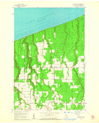
1961 · Cloverland
USGS Topo · 1:24,000
1961 · Lake Nebagamon
USGS Topo · 1:24,000
1961 · Brule
USGS Topo · 1:62,500