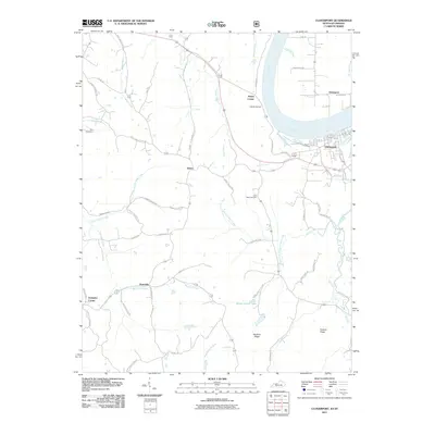
2011 Map of Cloverport
USGS Topo · Published 2011About this map
Cloverport sits at the northeastern edge of this map, positioned where Clover Creek meets the wide bend of the Ohio River. Across the water in Indiana, the settlement of Tobinsport marks the floodplain, connected to the Kentucky side by the river's historic transport corridor. The landscape transitions from the river valley into a series of ridges and hollows, such as Tuckers Ridge and Mullens Ridge, which define the local drainage patterns. Significant rural infrastructure is evident in the network of family-named roads like Truman Young Rd and Quisenberry Rd, reflecting long-standing local ties.
Find a feature on this map
54 named features on this map. Tap any name to fly to it.
Don’t see what you’re looking for? This feature index may not catch every label — zoom into the map to look around manually.
Map Details
Editions of this 2011 Cloverport Map
This is the sole edition of this map. No revisions or reprints were ever made.
Other maps of this area

1903 · Tell City
USGS Topo · 1:62,500

1907 · Whitesville
USGS Topo · 1:62,500

1909 · Whitesville
USGS Topo · 1:62,500

1932 · Fordsville
USGS Topo · 1:62,500

1934 · Cannelton
USGS Topo · 1:62,500

1949 · Cannelton
USGS Topo · 1:24,000

1953 · Cannelton
USGS Topo · 1:24,000

1953 · Cloverport
USGS Topo · 1:24,000

1953 · Whitesville
USGS Topo · 1:24,000

1953 · Tell City
USGS Topo · 1:24,000