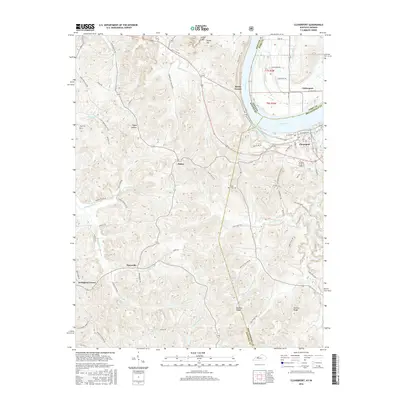
2016 Map of Cloverport
USGS Topo · Published 2016About this map
Cloverport sits prominently on a sharp bend of the Ohio River, serving as a focal point for this border region between Kentucky and Indiana. The terrain is characterized by a complex network of ridges and hollows, such as Mullens Ridge and Tucker Ridge, which dictate the winding paths of rural routes like Squirrel Tail Hollow Rd and Coal Bank Hollow Rd. This 2016 survey illustrates the persistent rural settlement patterns of Breckinridge and Hancock Counties, where small communities like Patesville, Arrington Corner, and Dukes remain connected by historical farm-to-market roads. Local history and genealogy are anchored by landmarks like Saint Rose Cem and Rice Cem, while the northern landscape is defined by the significant elevation of Jeffry Cliff and Shafer Hill. Waterways such as Indian Cr and Honey Locust Cr carve through the limestone-heavy geography, feeding into the river system that has historically driven the local economy.
Find a feature on this map
80 named features on this map. Tap any name to fly to it.
Don’t see what you’re looking for? This feature index may not catch every label — zoom into the map to look around manually.
Map Details
Editions of this 2016 Cloverport Map
This is the sole edition of this map. No revisions or reprints were ever made.
Other maps of this area

1903 · Tell City
USGS Topo · 1:62,500

1907 · Whitesville
USGS Topo · 1:62,500

1909 · Whitesville
USGS Topo · 1:62,500

1932 · Fordsville
USGS Topo · 1:62,500

1934 · Cannelton
USGS Topo · 1:62,500

1949 · Cannelton
USGS Topo · 1:24,000

1953 · Cannelton
USGS Topo · 1:24,000

1953 · Cloverport
USGS Topo · 1:24,000

1953 · Whitesville
USGS Topo · 1:24,000

1953 · Tell City
USGS Topo · 1:24,000