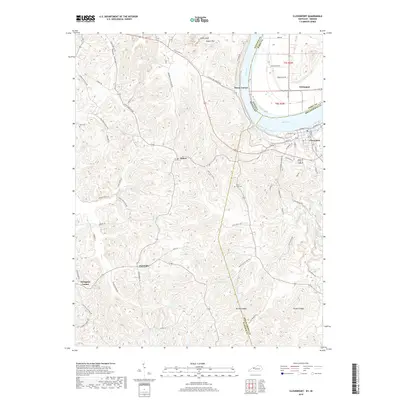
2019 Map of Cloverport
USGS Topo · Published 2019About this map
Cloverport sits prominently along the southern bank of the Ohio River, serving as a key riverfront hub where the border of Breckinridge and Hancock counties meets the Indiana state line. This 2019 survey illustrates the dense network of rural roads and hollows that define the Kentucky interior, including Coal Bank Hollow RD and Squirrel Tail Hollow RD. The landscape transitions from the river bottoms near Tobinsport and Sunny Corner to the higher elevations of Jeffry Cliff and Mullens Ridge. Small settlements and family-named landmarks like Dukes and Arrington Corner are scattered throughout the hills, connected by winding routes such as Old US HWY 60. Genealogists may find value in the location of Saint Rose Cem and Rice Cem, which provide historical anchors for families settled near Patesville and the surrounding timbered ridges.
Find a feature on this map
71 named features on this map. Tap any name to fly to it.
Don’t see what you’re looking for? This feature index may not catch every label — zoom into the map to look around manually.
Map Details
Editions of this 2019 Cloverport Map
This is the sole edition of this map. No revisions or reprints were ever made.
Other maps of this area

1903 · Tell City
USGS Topo · 1:62,500

1907 · Whitesville
USGS Topo · 1:62,500

1909 · Whitesville
USGS Topo · 1:62,500

1932 · Fordsville
USGS Topo · 1:62,500

1934 · Cannelton
USGS Topo · 1:62,500

1949 · Cannelton
USGS Topo · 1:24,000

1953 · Cannelton
USGS Topo · 1:24,000

1953 · Cloverport
USGS Topo · 1:24,000

1953 · Whitesville
USGS Topo · 1:24,000

1953 · Tell City
USGS Topo · 1:24,000