
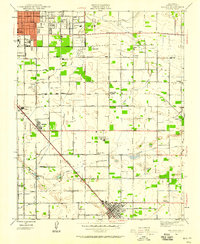
1923 Map of Clovis
USGS Topo · Published 1923About this map
Agricultural development and irrigation infrastructure define this corner of Fresno County in the early 1920s. The town of Clovis serves as the central hub, situated along the Southern Pacific railroad line which facilitated the movement of goods and people through the Central Valley. Small rural settlements and flag stops like Tarpey, Melvin, and Glorietta line the rail corridor, while the surrounding landscape is partitioned by an extensive network of water management features. Systems like the Enterprise Canal, Gould Canal, and Mc Kinley Ditch illustrate the engineering required to support the local orchards and vineyards.
Find a feature on this map
41 named features on this map. Tap any name to fly to it.
Don’t see what you’re looking for? This feature index may not catch every label — zoom into the map to look around manually.
Map Details
Editions of this 1923 Clovis Map
This is the sole edition of this map. No revisions or reprints were ever made.
Other maps of this area

1921 · Bullard
USGS Topo · 1:31,680

1922 · Round Mountain
USGS Topo · 1:31,680

1922 · Lanes Bridge
USGS Topo · 1:31,680

1922 · Friant
USGS Topo · 1:31,680

1923 · Malaga
USGS Topo · 1:31,680

1923 · Academy
USGS Topo · 1:31,680

1923 · Fresno
USGS Topo · 1:31,680

1923 · Sanger
USGS Topo · 1:31,680

1923 · Bullard
USGS Topo · 1:31,680
1946 · Malaga
USGS Topo · 1:24,000