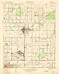
1947 Map of Clovis
USGS Topo · Published 1947About this map
The expanding agricultural and military landscape of Fresno County is centered on Clovis following the mid-century revision of this survey. The dominant feature of the southern plains is Hammer Field, a significant installation surrounded by irrigation infrastructure and small rail stops like Tarpey and Cameo. The region’s educational and social network is clearly defined by numerous rural schools, including Nees Colony Sch and Scandinavian Sch, which served the outlying agricultural colonies.
Find a feature on this map
57 named features on this map. Tap any name to fly to it.
Don’t see what you’re looking for? This feature index may not catch every label — zoom into the map to look around manually.
Map Details
Editions of this 1947 Clovis Map
2 editions found
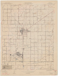
Other maps of this area

1921 · Bullard
USGS Topo · 1:31,680

1922 · Round Mountain
USGS Topo · 1:31,680

1922 · Lanes Bridge
USGS Topo · 1:31,680

1922 · Friant
USGS Topo · 1:31,680

1923 · Malaga
USGS Topo · 1:31,680

1923 · Academy
USGS Topo · 1:31,680

1923 · Fresno
USGS Topo · 1:31,680

1923 · Clovis
USGS Topo · 1:31,680

1923 · Sanger
USGS Topo · 1:31,680

1923 · Bullard
USGS Topo · 1:31,680