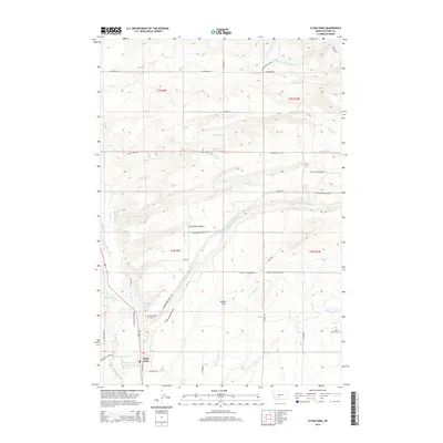
2014 Map of Clyde Park
USGS Topo · Published 2014About this map
Shields River flows along the western edge of this Montana landscape, where the settlement of Clyde Park serves as a central point for the surrounding ranching and agricultural lands. The terrain is defined by prominent elevations such as Moolsh Hill and the broad Cottonwood Bench, which is crisscrossed by irrigation and natural drainage systems. The map detail highlights a network of rural routes, including Cottonwood Bench Rd and Upper Cottonwood Rd, that connect isolated homesteads and family-named landmarks.
Find a feature on this map
46 named features on this map. Tap any name to fly to it.
Don’t see what you’re looking for? This feature index may not catch every label — zoom into the map to look around manually.
Map Details
Editions of this 2014 Clyde Park Map
This is the sole edition of this map. No revisions or reprints were ever made.
Other maps of this area

1886 · Little Belt Mts.
USGS Topo · 1:250,000

1891 · Livingston
USGS Topo · 1:250,000

1893 · Livingston
USGS Topo · 1:250,000

1894 · Little Belt Mts.
USGS Topo · 1:250,000

1897 · Little Belt Mts.
USGS Topo · 1:250,000

1898 · Little Belt Mts.
USGS Topo · 1:250,000

1902 · Little Belt Mts.
USGS Topo · 1:250,000

1947 · Bozeman
USGS Topo · 1:250,000

1948 · Bozeman
USGS Topo · 1:250,000

1948 · White Sulphur Springs
USGS Topo · 1:250,000