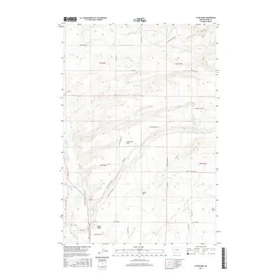
2017 Map of Clyde Park
USGS Topo · Published 2017About this map
Clyde Park serves as the primary hub of this Shield River Valley landscape, centered at the crossroads of W Main St and 1st Ave. The map illustrates a well-developed network of rural roads such as Lower Cottonwood Rd and Horse Creek Rd that service the surrounding agricultural land. The terrain is defined by the high, flat expanse of Cottonwood Bench and the prominent Moolsh Hill, which rise above the complex drainage systems of the Shields River and its numerous tributaries, including Cottonwood Cr and Little Indian Cr. Local history is anchored by sites such as the Clyde Park Cem and the more remote Rock Creek Cem to the east. The section lines of the Public Land Survey System are clearly visible, marking the grid-like division of Park County into townships like t3n r9e.
Find a feature on this map
85 named features on this map. Tap any name to fly to it.
Don’t see what you’re looking for? This feature index may not catch every label — zoom into the map to look around manually.
Map Details
Editions of this 2017 Clyde Park Map
This is the sole edition of this map. No revisions or reprints were ever made.
Other maps of this area

1886 · Little Belt Mts.
USGS Topo · 1:250,000

1891 · Livingston
USGS Topo · 1:250,000

1893 · Livingston
USGS Topo · 1:250,000

1894 · Little Belt Mts.
USGS Topo · 1:250,000

1897 · Little Belt Mts.
USGS Topo · 1:250,000

1898 · Little Belt Mts.
USGS Topo · 1:250,000

1902 · Little Belt Mts.
USGS Topo · 1:250,000

1947 · Bozeman
USGS Topo · 1:250,000

1948 · Bozeman
USGS Topo · 1:250,000

1948 · White Sulphur Springs
USGS Topo · 1:250,000