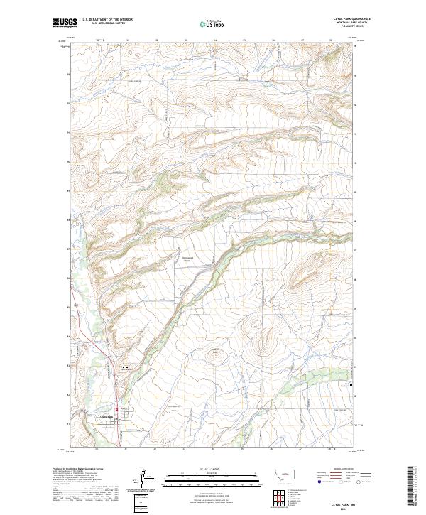
2024 Map of Clyde Park
USGS Topo · Published 2024About this map
Clyde Park serves as the primary settlement in this northern section of the Shields River valley, situated where Brackett Creek Rd and W Main St meet. The township's layout is defined by its proximity to the Shields River, with local history etched into the landscape at Saint Margarets Cem and the Clyde Park Cem. To the east, the terrain rises toward Cottonwood Bench and Moolsh Hill, revealing a network of rural routes named for early residents and landmarks, such as Laubscher Bodine Rd and Bailey Rd.
Find a feature on this map
52 named features on this map. Tap any name to fly to it.
Don’t see what you’re looking for? This feature index may not catch every label — zoom into the map to look around manually.
Map Details
Editions of this 2024 Clyde Park Map
This is the sole edition of this map. No revisions or reprints were ever made.
Other maps of this area

1886 · Little Belt Mts.
USGS Topo · 1:250,000

1891 · Livingston
USGS Topo · 1:250,000

1893 · Livingston
USGS Topo · 1:250,000

1894 · Little Belt Mts.
USGS Topo · 1:250,000

1897 · Little Belt Mts.
USGS Topo · 1:250,000

1898 · Little Belt Mts.
USGS Topo · 1:250,000

1902 · Little Belt Mts.
USGS Topo · 1:250,000

1947 · Bozeman
USGS Topo · 1:250,000

1948 · Bozeman
USGS Topo · 1:250,000

1948 · White Sulphur Springs
USGS Topo · 1:250,000