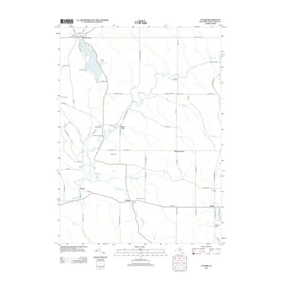
2013 Map of Clymer
USGS Topo · Published 2013About this map
Findley Lake serves as a prominent recreational and residential focal point in this corner of Chautauqua County, with Paradise Bay Park and Camp Findley lining its shores. The landscape is defined by the winding course of French Creek, which flows past the settlement of French Creek and under the French Creek Bridge. This 2013 survey illustrates a rural dairy and agricultural region dotted with family-named farms such as Boozel Farms, Willink Farms, and Dunnewold Farms. For genealogists, the map is particularly useful for locating several small burial grounds, including the Holland Cem, Taft Cem, and Saint Matthias Cem. Small hamlets like Cutting, Marvin, and Clymer act as local hubs connected by a network of rural routes, while the distinct topography of Lathrup Gulf marks the southeastern corner near the Pennsylvania border.
Find a feature on this map
71 named features on this map. Tap any name to fly to it.
Don’t see what you’re looking for? This feature index may not catch every label — zoom into the map to look around manually.
Map Details
Editions of this 2013 Clymer Map
This is the sole edition of this map. No revisions or reprints were ever made.
Other maps of this area

1905 · Clymer
USGS Topo · 1:62,500

1913 · North East
USGS Topo · 1:62,500

1915 · North East
USGS Topo · 1:62,500

1929 · Corry
USGS Topo · 1:48,000

1929 · Union City
USGS Topo · 1:62,500

1932 · Corry
USGS Topo · 1:62,500

1932 · Union City
USGS Topo · 1:62,500

1939 · Clymer
USGS Topo · 1:62,500

1941 · Clymer
USGS Topo · 1:62,500

1943 · North East
USGS Topo · 1:62,500