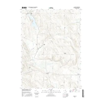
2016 Map of Clymer
USGS Topo · Published 2016About this map
Findley Lake serves as a prominent landmark in the northwest corner of this Chautauqua County landscape, where small hamlets are connected by a network of rural roads and creek crossings. The drainage patterns of French Creek and its tributaries, including Beaver Meadow Brook and Cutting Brook, dictate the positioning of settlements like Cutting and Marvin. This survey provides a precise account of the area's local history through its many burial grounds, ranging from the Saint Matthias Cem near the French Creek Bridge to the Holland Cem further east. The transition from the clustered houses of Findley Lake to the more dispersed crossroads at Morgan Corners illustrates the persistent agricultural and recreational character of southwestern New York in the early 21st century.
Find a feature on this map
61 named features on this map. Tap any name to fly to it.
Don’t see what you’re looking for? This feature index may not catch every label — zoom into the map to look around manually.
Map Details
Editions of this 2016 Clymer Map
This is the sole edition of this map. No revisions or reprints were ever made.
Other maps of this area

1905 · Clymer
USGS Topo · 1:62,500

1913 · North East
USGS Topo · 1:62,500

1915 · North East
USGS Topo · 1:62,500

1929 · Corry
USGS Topo · 1:48,000

1929 · Union City
USGS Topo · 1:62,500

1932 · Corry
USGS Topo · 1:62,500

1932 · Union City
USGS Topo · 1:62,500

1939 · Clymer
USGS Topo · 1:62,500

1941 · Clymer
USGS Topo · 1:62,500

1943 · North East
USGS Topo · 1:62,500