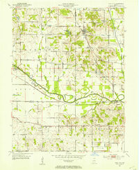
1953 Map of Coal City
USGS Topo · Published 1953About this map
Coal City serves as a central hub in this mid-century look at the borderlands of Clay, Owen, and Greene counties. The landscape is heavily marked by the region's extractive economy, with numerous Strip Mines and the tracks of the New York Central railroad defining the local industry. A significant historical marker is the path of the Wabash and Erie Canal, noted here as abandoned as it follows the southern bank of the Eel River. Local life is anchored by small communities like Stockton, Daggett, and Hubbell, alongside rural institutions such as New Hope Ch, Mt Vernon Ch, and the Dean Sch. The map also captures numerous family-named burial grounds, including the Sink, Winters, and Fiscus cemeteries, providing a detailed record for genealogical research in this part of Indiana.
Find a feature on this map
37 named features on this map. Tap any name to fly to it.
Don’t see what you’re looking for? This feature index may not catch every label — zoom into the map to look around manually.
Map Details
Editions of this 1953 Coal City Map
This is the sole edition of this map. No revisions or reprints were ever made.
Other maps of this area

1908 · Clay City
USGS Topo · 1:48,000

1908 · Bloomfield
USGS Topo · 1:62,500

1910 · Clay City
USGS Topo · 1:62,500

1938 · Coal City
USGS Topo · 1:24,000

1938 · Switz City
USGS Topo · 1:24,000

1940 · Linton
USGS Topo · 1:24,000

1940 · Jasonville
USGS Topo · 1:24,000

1947 · Switz City
USGS Topo · 1:24,000

1947 · Linton
USGS Topo · 1:24,000

1948 · Coal City
USGS Topo · 1:24,000