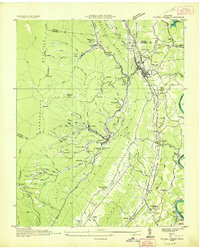
1936 Map of Coal Creek
USGS Topo · Published 1936About this map
The mining and mountain settlements of Anderson County are captured in this 1936 survey, which documents the landscape just as the Tennessee Valley Authority began shaping the region. The map reveals the industrial heart of the area, centered on the Coal Creek valley and the surrounding ridges of Walden Ridge and Vowell Mountain. This era is marked by the presence of numerous small mining communities like Briceville, Fraterville, and Minersville, connected by a network of tramways and branches of the Southern Railway.
Find a feature on this map
113 named features on this map. Tap any name to fly to it.
Don’t see what you’re looking for? This feature index may not catch every label — zoom into the map to look around manually.
Map Details
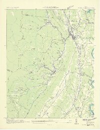
Editions of this 1936 Coal Creek Map
2 editions found
Other maps of this area

1893 · Briceville
USGS Topo · 1:125,000

1895 · Briceville
USGS Topo · 1:125,000

1896 · Briceville
USGS Topo · 1:125,000

1936 · Block
USGS Topo · 1:24,000

1936 · Jacksboro
USGS Topo · 1:24,000

1936 · Duncan Flats
USGS Topo · 1:24,000

1936 · Windrock
USGS Topo · 1:24,000

1936 · La Follette
USGS Topo · 1:48,000

1936 · Norris Dam
USGS Topo · 1:48,000
1936 · Demory
USGS Topo · 1:24,000