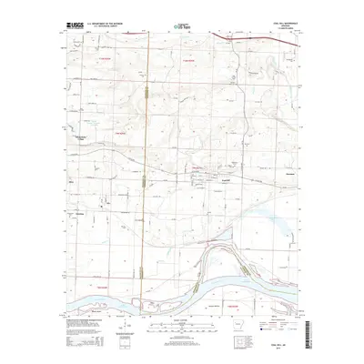
2014 Map of Coal Hill
USGS Topo · Published 2014About this map
Coal Hill and the surrounding river valley communities sit at the heart of this landscape where the Arkansas River meets Lake Dardanelle. This area is defined by its diverse local economies, from the viticulture around Wiederkehr Village and the Swiss Family Vineyards Reservoir to the energy production visible at the Coal Hill Gas Field and Alix Gas Field. The map records a dense network of family-named cemeteries such as Huddleston Cem, Hess Cem, and Burnett Cem, providing vital clues for genealogical research in Johnson and Franklin counties.
Find a feature on this map
122 named features on this map. Tap any name to fly to it.
Don’t see what you’re looking for? This feature index may not catch every label — zoom into the map to look around manually.
Map Details
Editions of this 2014 Coal Hill Map
This is the sole edition of this map. No revisions or reprints were ever made.
Other maps of this area

1879 · Cravens
USGS Topo · 1:62,500

1887 · Magazine Mountain #1
USGS Topo · 1:62,500

1887 · Magazine Mountain #2
USGS Topo · 1:62,500

1887 · Watalula
USGS Topo · 1:62,500

1887 · Magazine Mountain
USGS Topo · 1:62,500

1890 · Magazine Mountain
USGS Topo · 1:125,000

1906 · Batson
USGS Topo · 1:62,500

1939 · Watalula
USGS Topo · 1:62,500

1956 · Russellville
USGS Topo · 1:250,000

1961 · Coal Hill
USGS Topo · 1:24,000