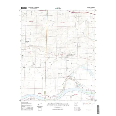
2017 Map of Coal Hill
USGS Topo · Published 2017About this map
Coal Hill and the surrounding river bottoms define this section of the Arkansas River valley along the border of Franklin and Johnson Counties. The landscape is marked by a legacy of rural development, from the established vineyard culture at Wiederkehr Village to the clusters of family cemeteries that dot the hillsides, including the Huddleston Cem, Srygley Cem, and Hess Cem. Settlement patterns follow the east-west corridor through Altus and Denning, where the terrain transitions from the higher northern ridges down toward the broad floodplain of the Arkansas River. To the south, the river creates a complex hydrology featuring the McLean Bottom Cutoff and the northern reaches of Lake Dardanelle. This area is characterized by a dense network of county roads, such as Co RD 517 and Hilltop Rd, which connect the small communities and agricultural lands situated between McKinney Cr and Horsehead Creek.
Find a feature on this map
121 named features on this map. Tap any name to fly to it.
Don’t see what you’re looking for? This feature index may not catch every label — zoom into the map to look around manually.
Map Details
Editions of this 2017 Coal Hill Map
This is the sole edition of this map. No revisions or reprints were ever made.
Other maps of this area

1879 · Cravens
USGS Topo · 1:62,500

1887 · Magazine Mountain #1
USGS Topo · 1:62,500

1887 · Magazine Mountain #2
USGS Topo · 1:62,500

1887 · Watalula
USGS Topo · 1:62,500

1887 · Magazine Mountain
USGS Topo · 1:62,500

1890 · Magazine Mountain
USGS Topo · 1:125,000

1906 · Batson
USGS Topo · 1:62,500

1939 · Watalula
USGS Topo · 1:62,500

1956 · Russellville
USGS Topo · 1:250,000

1961 · Coal Hill
USGS Topo · 1:24,000