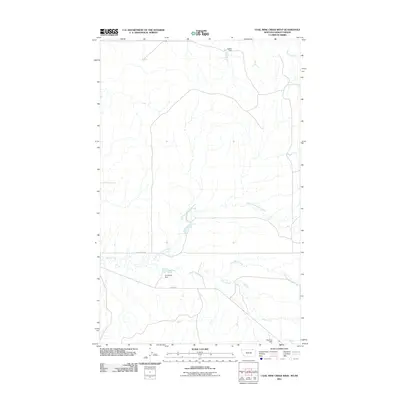
2011 Map of Coal Mine Creek West
USGS Topo · Published 2011About this map
Small earthen dams and intermittent waterways define this prairie landscape in Valley County along the Montana-Saskatchewan border. Local infrastructure is primarily represented by Theony Rd and Old Theony Rd, which traverse an area shaped by the seasonal flow of Coal Mine Creek and its various forks. The name of the creek itself points to the region's historic relationship with small-scale resource extraction.
Find a feature on this map
9 named features on this map. Tap any name to fly to it.
Don’t see what you’re looking for? This feature index may not catch every label — zoom into the map to look around manually.
Map Details
Editions of this 2011 Coal Mine Creek West Map
This is the sole edition of this map. No revisions or reprints were ever made.
Other maps of this area

1919 · Boundary
USGS Topo · 1:125,000

1954 · Glasgow
USGS Topo · 1:250,000

1957 · Glasgow
USGS Topo · 1:250,000

1958 · Glasgow
USGS Topo · 1:250,000

1984 · O'Juel Lake
USGS Topo · 1:24,000

1984 · Lighthouse Hill
USGS Topo · 1:24,000

1984 · Opheim
USGS Topo · 1:100,000

1984 · Dodge Reservoir
USGS Topo · 1:24,000

1984 · Last Chance Reservoir
USGS Topo · 1:24,000
1984 · Coal Mine Creek East
USGS Topo · 1:24,000