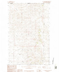
1984 Map of Coal Mine Creek East
USGS Topo · Published 1984About this map
Opheim Hills dominate this portion of the borderlands between Saskatchewan and Montana, a region defined by complex drainage systems and isolated landmarks. The landscape in Valley County is deeply dissected by numerous watercourses, including the North Fork South Creek and the meandering Morgan Creek. Resource extraction is evidenced by a Gravel Pit near the creek beds, while the topography is punctuated by prominent rises such as Round Butte and Coal Mine Hill. The map meticulously traces the international boundary line, showing the remote character of this high plains territory where cattle trails and coulees like Fox Coulee and Slaughter Creek provide the primary geographic orientation. This late-twentieth-century study captures the land before modern intensive development, preserving the original hydrography of Coal Mine Creek and its surrounding bluffs.
Find a feature on this map
13 named features on this map. Tap any name to fly to it.
Don’t see what you’re looking for? This feature index may not catch every label — zoom into the map to look around manually.
Map Details
Editions of this 1984 Coal Mine Creek East Map
This is the sole edition of this map. No revisions or reprints were ever made.
Other maps of this area

1919 · Boundary
USGS Topo · 1:125,000

1954 · Glasgow
USGS Topo · 1:250,000

1957 · Glasgow
USGS Topo · 1:250,000

1958 · Glasgow
USGS Topo · 1:250,000

1973 · Opheim
USGS Topo · 1:24,000

1973 · Roanwood
USGS Topo · 1:24,000

1984 · O'Juel Lake
USGS Topo · 1:24,000

1984 · Opheim
USGS Topo · 1:100,000

1984 · Dodge Reservoir
USGS Topo · 1:24,000
1984 · Coal Mine Creek West
USGS Topo · 1:24,000