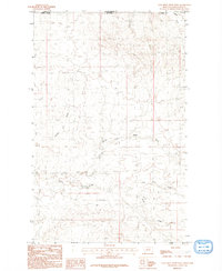
1984 Map of Coal Mine Creek West
USGS Topo · Published 1984About this map
Valley County, Montana, meets the Saskatchewan border in this mid-1980s topographical study of the high plains north of the Missouri River. The landscape is defined by the intricate dendritic drainage patterns of seasonal waterways, most notably the meandering course of South Coal Mine Creek and its southern tributaries. The map documents the international boundary where the United States and Canada meet, a transition from the rolling terrain of Valley County into the Canadian province of Saskatchewan. Small, local drainages like Tomato Can Creek and the North Fork South Creek carve through the northern Montana breaks, illustrating the hydrological network that sustains this sparsely settled ranching and mining region. This provisional edition preserves the precise elevations and landform data recorded during field checks in the late 1970s.
Find a feature on this map
7 named features on this map. Tap any name to fly to it.
Don’t see what you’re looking for? This feature index may not catch every label — zoom into the map to look around manually.
Map Details
Editions of this 1984 Coal Mine Creek West Map
This is the sole edition of this map. No revisions or reprints were ever made.
Other maps of this area

1919 · Boundary
USGS Topo · 1:125,000

1954 · Glasgow
USGS Topo · 1:250,000

1957 · Glasgow
USGS Topo · 1:250,000

1958 · Glasgow
USGS Topo · 1:250,000

1984 · O'Juel Lake
USGS Topo · 1:24,000

1984 · Lighthouse Hill
USGS Topo · 1:24,000

1984 · Opheim
USGS Topo · 1:100,000

1984 · Dodge Reservoir
USGS Topo · 1:24,000

1984 · Last Chance Reservoir
USGS Topo · 1:24,000
1984 · Coal Mine Creek East
USGS Topo · 1:24,000