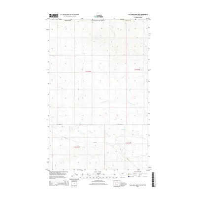
2014 Map of Coal Mine Creek West
USGS Topo · Published 2014About this map
South Creek and its tributary, N Fork South Creek, carve a series of drainages across this northern Valley County landscape. The terrain is defined by the ephemeral waterways of the Coal Mine Cr basin, illustrating the drainage patterns characteristic of the high plains near the Canadian border. Settlement history is traced through the presence of Theony Rd and Old Theony Rd, routes that once connected the now-unlabeled community of Theony to the surrounding ranchlands. The map provides a clear look at the Public Land Survey System grid, with townships including t37n r38e and t36n r39e marking the transition from open grazing land to the rugged breaks above the creek beds.
Find a feature on this map
11 named features on this map. Tap any name to fly to it.
Don’t see what you’re looking for? This feature index may not catch every label — zoom into the map to look around manually.
Map Details
Editions of this 2014 Coal Mine Creek West Map
This is the sole edition of this map. No revisions or reprints were ever made.
Other maps of this area

1919 · Boundary
USGS Topo · 1:125,000

1954 · Glasgow
USGS Topo · 1:250,000

1957 · Glasgow
USGS Topo · 1:250,000

1958 · Glasgow
USGS Topo · 1:250,000

1984 · O'Juel Lake
USGS Topo · 1:24,000

1984 · Lighthouse Hill
USGS Topo · 1:24,000

1984 · Opheim
USGS Topo · 1:100,000

1984 · Dodge Reservoir
USGS Topo · 1:24,000

1984 · Last Chance Reservoir
USGS Topo · 1:24,000
1984 · Coal Mine Creek East
USGS Topo · 1:24,000