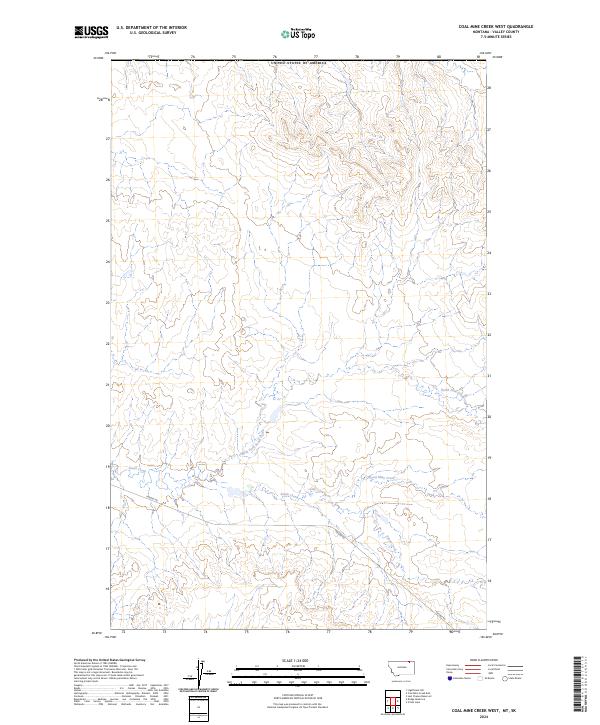
2024 Map of Coal Mine Creek West
USGS Topo · Published 2024About this map
Coal Mine Creek and the headwaters of the South Creek drainage system characterize this portion of Valley County, Montana. The landscape is defined by the complex hydrology of the North Fork South Creek, where seasonal watercourses have carved intricate patterns into the terrain. The presence of Theony Rd provides a primary point of access through the southern sections of the quadrangle, crossing the various forks of South Creek. This area remains largely dominated by the Public Land Survey System grid, with township boundaries for t37n r38e and t36n r39e marking the division of the prairie. The geography reflects a sparse, working landscape where the natural drainage of Coal Mine Creek dictates the movement and development across the high plains.
Find a feature on this map
9 named features on this map. Tap any name to fly to it.
Don’t see what you’re looking for? This feature index may not catch every label — zoom into the map to look around manually.
Map Details
Editions of this 2024 Coal Mine Creek West Map
This is the sole edition of this map. No revisions or reprints were ever made.
Other maps of this area

1919 · Boundary
USGS Topo · 1:125,000

1954 · Glasgow
USGS Topo · 1:250,000

1957 · Glasgow
USGS Topo · 1:250,000

1958 · Glasgow
USGS Topo · 1:250,000

1984 · O'Juel Lake
USGS Topo · 1:24,000

1984 · Lighthouse Hill
USGS Topo · 1:24,000

1984 · Opheim
USGS Topo · 1:100,000

1984 · Dodge Reservoir
USGS Topo · 1:24,000

1984 · Last Chance Reservoir
USGS Topo · 1:24,000
1984 · Coal Mine Creek East
USGS Topo · 1:24,000