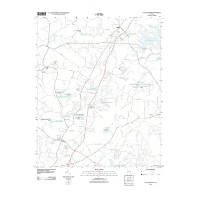
2011 Map of Coal Mountain
USGS Topo · Published 2011About this map
Silver City and Coal Mountain define the settled landscape of this Forsyth County region during the early 21st century. The map reveals an area defined by water management and rural transition, where the Etowah River and its tributaries are controlled by numerous structures such as Etowah River Watershed Dam Number Nine and Norrell Lake Dam. The eastern edge is dominated by the sprawling reaches of Lake Sidney Lanier, featuring the Thompson Creek Access Point.
Find a feature on this map
101 named features on this map. Tap any name to fly to it.
Don’t see what you’re looking for? This feature index may not catch every label — zoom into the map to look around manually.
Map Details
Editions of this 2011 Coal Mountain Map
This is the sole edition of this map. No revisions or reprints were ever made.
Other maps of this area

1890 · Suwanee
USGS Topo · 1:125,000

1891 · Gainesville
USGS Topo · 1:125,000

1894 · Suwanee
USGS Topo · 1:125,000

1954 · Greenville
USGS Topo · 1:250,000

1955 · Rome
USGS Topo · 1:250,000

1958 · Greenville
USGS Topo · 1:250,000

1958 · Rome
USGS Topo · 1:250,000

1961 · Rome
USGS Topo · 1:250,000

1963 · Rome
USGS Topo · 1:250,000

1964 · Murrayville
USGS Topo · 1:24,000