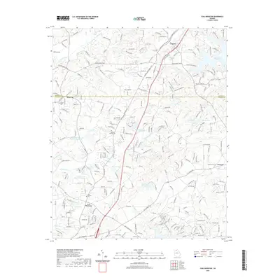
2020 Map of Coal Mountain
USGS Topo · Published 2020About this map
Coal Mountain and Silver-City anchor this northern Georgia landscape at the interface of several water systems. The northern edge follows the Etowah River and its tributary Mill Cr, while the eastern boundary is defined by the inlets of Lake Sidney Lanier, specifically around Chestatee. The map reveals a complex water management system involving multiple reservoirs, including Settingdown Cr Watershed to Reservoir and Reservoir Four, which support local infrastructure like the Rendering Plant Lake. Genealogists will find significant value in the distribution of family and community burial sites, from the Byrd Family Cem in the north near Lumpkin to the Ebenezer Cem in the south. The transition from the ridges of Trillium Ridge to the lowlands along Squattingdown Cr illustrates the varied terrain of the Dawson and Forsyth county line.
Find a feature on this map
232 named features on this map. Tap any name to fly to it.
Don’t see what you’re looking for? This feature index may not catch every label — zoom into the map to look around manually.
Map Details
Editions of this 2020 Coal Mountain Map
This is the sole edition of this map. No revisions or reprints were ever made.
Other maps of this area

1890 · Suwanee
USGS Topo · 1:125,000

1891 · Gainesville
USGS Topo · 1:125,000

1894 · Suwanee
USGS Topo · 1:125,000

1954 · Greenville
USGS Topo · 1:250,000

1955 · Rome
USGS Topo · 1:250,000

1958 · Greenville
USGS Topo · 1:250,000

1958 · Rome
USGS Topo · 1:250,000

1961 · Rome
USGS Topo · 1:250,000

1963 · Rome
USGS Topo · 1:250,000

1964 · Murrayville
USGS Topo · 1:24,000