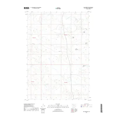
2017 Map of Coal Springs SW
USGS Topo · Published 2017About this map
The high plains of Perkins County define this landscape, where distinctive geological rises break the horizon of the western Dakotas. Prominent landforms such as Duncan Butte, Curiosity Butte, and Wedgetent Butte serve as critical navigational landmarks in a region largely shaped by the drainage patterns of Thunder Butte Cr and its tributaries. The drainage network, including Cottonwood Cr and Duncan Cr, illustrates how water movement has carved out features like School Section Draw and Boggy Draw over time. Human imprint on this terrain is minimal and follow the natural contours of the land, primarily represented by the intersection of Foster Rd and Happy Hill Rd. This survey by the U.S. Geological Survey provides a detailed look at the township and range system that organized this corner of the state, including the boundaries of t16n r16e and t15n r15e.
Find a feature on this map
15 named features on this map. Tap any name to fly to it.
Don’t see what you’re looking for? This feature index may not catch every label — zoom into the map to look around manually.
Map Details
Editions of this 2017 Coal Springs SW Map
This is the sole edition of this map. No revisions or reprints were ever made.
Other maps of this area

1951 · Faith NE
USGS Topo · 1:24,000

1952 · Deep Creek NE
USGS Topo · 1:24,000

1952 · Faith NW
USGS Topo · 1:24,000

1954 · Lemmon
USGS Topo · 1:250,000

1957 · Lemmon
USGS Topo · 1:250,000

1983 · Coal Springs
USGS Topo · 1:24,000

1983 · Sunrise Butte
USGS Topo · 1:24,000

1983 · Coal Springs SW
USGS Topo · 1:24,000
1983 · Coal Springs SE
USGS Topo · 1:24,000

1983 · Coal Springs NW
USGS Topo · 1:24,000