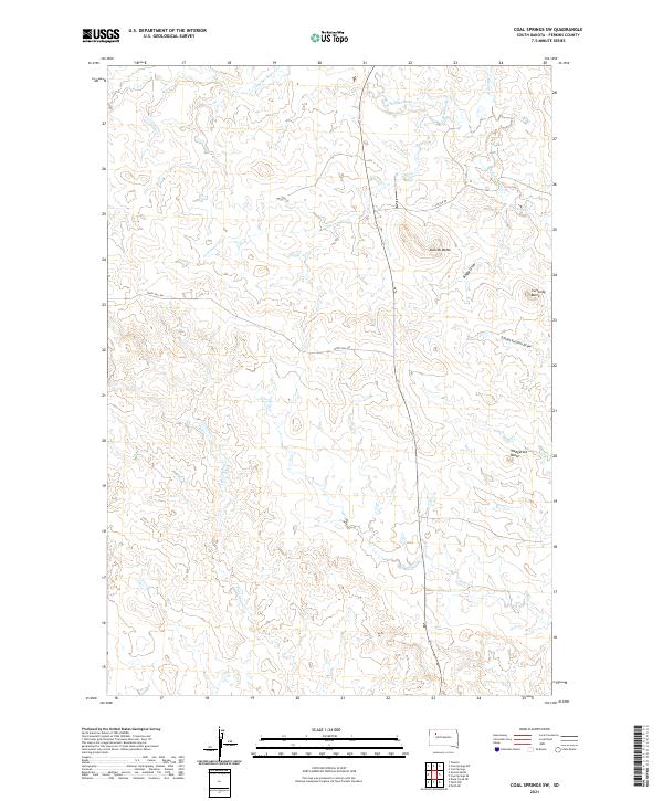
2021 Map of Coal Springs SW
USGS Topo · Published 2021About this map
Duncan Butte and a series of prominent elevations define this Perkins County landscape, where the high plains of South Dakota are carved by numerous intermittent drainage systems. The hydrology of the region is centered on Thunder Butte Cr and its tributaries, including Cottonwood Cr and Duncan Cr, which create a complex network of draws and breaks. These natural features, such as Boggy Draw and School Section Draw, dictate the path of local infrastructure like Happy Hill Rd and Foster Rd.
Find a feature on this map
15 named features on this map. Tap any name to fly to it.
Don’t see what you’re looking for? This feature index may not catch every label — zoom into the map to look around manually.
Map Details
Editions of this 2021 Coal Springs SW Map
This is the sole edition of this map. No revisions or reprints were ever made.
Other maps of this area

1951 · Faith NE
USGS Topo · 1:24,000

1952 · Deep Creek NE
USGS Topo · 1:24,000

1952 · Faith NW
USGS Topo · 1:24,000

1954 · Lemmon
USGS Topo · 1:250,000

1957 · Lemmon
USGS Topo · 1:250,000

1983 · Coal Springs
USGS Topo · 1:24,000

1983 · Sunrise Butte
USGS Topo · 1:24,000

1983 · Coal Springs SW
USGS Topo · 1:24,000
1983 · Coal Springs SE
USGS Topo · 1:24,000

1983 · Coal Springs NW
USGS Topo · 1:24,000