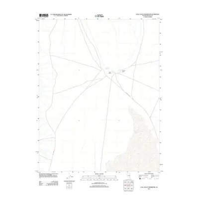
2012 Map of Coal Valley Reservoir
USGS Topo · Published 2012About this map
Coal Valley in Lincoln County defines this arid landscape, centered on a series of critical water management features in a high-desert environment. The map highlights the localized reliance on reservoirs such as Coal Valley Reservoir and Sheep Reservoir Number 2, which serve as vital hubs in an otherwise sparse region. The inclusion of the Coal Valley Holding Field suggests the area's continued use for livestock management, a traditional land-use pattern typical of this part of Nevada. Navigation through the valley is facilitated by long, unpaved thoroughfares including Mail Summit Rd and Seaman Wash Rd, which intersect near the reservoirs. The southeastern portion of the quadrangle is dominated by the dry bed of the East Coal Valley Reservoir, illustrating the seasonal or ephemeral nature of water resources in this remote Basin and Range territory.
Find a feature on this map
7 named features on this map. Tap any name to fly to it.
Don’t see what you’re looking for? This feature index may not catch every label — zoom into the map to look around manually.
Map Details
Editions of this 2012 Coal Valley Reservoir Map
This is the sole edition of this map. No revisions or reprints were ever made.
Other maps of this area

1954 · Caliente
USGS Topo · 1:250,000

1956 · Lund
USGS Topo · 1:250,000

1959 · Caliente
USGS Topo · 1:250,000

1960 · Lund
USGS Topo · 1:250,000

1970 · Oreana Spring
USGS Topo · 1:24,000

1970 · Seaman Wash
USGS Topo · 1:24,000
1971 · Timber Mtn Pass West
USGS Topo · 1:24,000

1985 · Water Gap East
USGS Topo · 1:24,000

1985 · Coal Valley Reservoir
USGS Topo · 1:24,000

1985 · Murphy Gap
USGS Topo · 1:24,000