
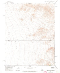
1985 Map of Coal Valley Reservoir
USGS Topo · Published 1986About this map
The Golden Gate Range defines the western edge of this arid Nevada landscape, which transitions into the wide expanse of Coal Valley. Grounded in data from a 1981 field check, this map reveals a high-desert environment where water management is paramount, centered on the Coal Valley Reservoir and Sheep Reservoir No 2. These isolated water features, along with a noted Depression to the south, highlight the unique hydrological challenges of Lincoln County. The mapping also delineates a critical geographic marker, the Base Line, and a network of 4wd routes that suggest a landscape primarily utilized for range management and remote access rather than permanent settlement. Large stretches of sand underscore the seasonal and shifting nature of the local terrain.
Find a feature on this map
8 named features on this map. Tap any name to fly to it.
Don’t see what you’re looking for? This feature index may not catch every label — zoom into the map to look around manually.
Map Details
Editions of this 1985 Coal Valley Reservoir Map
This is the sole edition of this map. No revisions or reprints were ever made.
Other maps of this area

1954 · Caliente
USGS Topo · 1:250,000

1956 · Lund
USGS Topo · 1:250,000

1959 · Caliente
USGS Topo · 1:250,000

1960 · Lund
USGS Topo · 1:250,000

1970 · Oreana Spring
USGS Topo · 1:24,000

1970 · Seaman Wash
USGS Topo · 1:24,000
1971 · Timber Mtn Pass West
USGS Topo · 1:24,000

1985 · Water Gap East
USGS Topo · 1:24,000

1985 · Murphy Gap
USGS Topo · 1:24,000

1985 · Murphy Gap NW
USGS Topo · 1:24,000