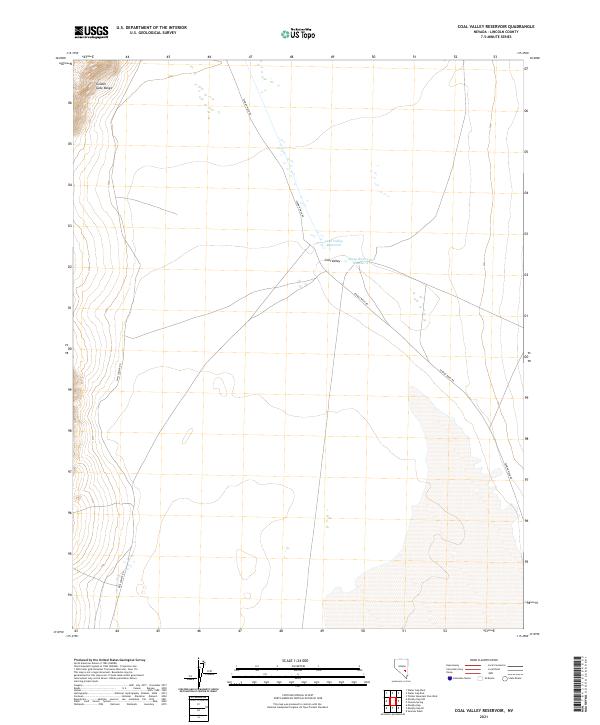
2021 Map of Coal Valley Reservoir
USGS Topo · Published 2021About this map
Coal Valley Reservoir and the adjacent Sheep Reservoir Number 2 sit at the center of this Lincoln County basin, serving as critical water infrastructure in a high-desert environment. The landscape is defined by the sharp rise of the Golden Gate Range in the northwest, which transitions into broad, open flats segmented by historical township and range lines. Transportation through this remote stretch of Nevada relies on established routes such as Seaman Wash Rd and Mail Summit Rd, which trace the natural contours of the valley. The map documents the persistent human effort to manage water in the arid Coal-Valley region, providing a clear record of land management and surveying across multiple townships including T2N R59E and T1N R60E.
Find a feature on this map
12 named features on this map. Tap any name to fly to it.
Don’t see what you’re looking for? This feature index may not catch every label — zoom into the map to look around manually.
Map Details
Editions of this 2021 Coal Valley Reservoir Map
This is the sole edition of this map. No revisions or reprints were ever made.
Other maps of this area

1954 · Caliente
USGS Topo · 1:250,000

1956 · Lund
USGS Topo · 1:250,000

1959 · Caliente
USGS Topo · 1:250,000

1960 · Lund
USGS Topo · 1:250,000

1970 · Oreana Spring
USGS Topo · 1:24,000

1970 · Seaman Wash
USGS Topo · 1:24,000
1971 · Timber Mtn Pass West
USGS Topo · 1:24,000

1985 · Water Gap East
USGS Topo · 1:24,000

1985 · Coal Valley Reservoir
USGS Topo · 1:24,000

1985 · Murphy Gap
USGS Topo · 1:24,000