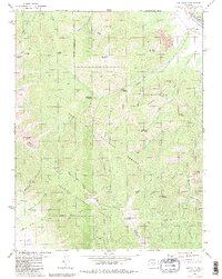
1980 Map of Coaldale
USGS Topo · Published 1981About this map
The Arkansas River corridor near the settlement of Coaldale defines this high-elevation landscape, where the D & Rgw railroad tracks skirt the riverbank as it passes through the mountain gap. The map captures a transition from the riparian valley floor to the high peaks of the San Isabel National Forest, including notable summits like Nipple Mountain and Galena Peak. Human activity is concentrated around the river, visible in the Strip Mine and the local Cem, while the interior is marked by a network of steep routes including the Rainbow Trail and the Stout Creek Trail.
Find a feature on this map
62 named features on this map. Tap any name to fly to it.
Don’t see what you’re looking for? This feature index may not catch every label — zoom into the map to look around manually.
Map Details
Editions of this 1980 Coaldale Map
2 editions found
Other maps of this area

1950 · Valley View Hot Springs
USGS Topo · 1:24,000

1954 · Pueblo
USGS Topo · 1:250,000

1957 · Pueblo
USGS Topo · 1:250,000

1958 · Pueblo
USGS Topo · 1:250,000

1959 · Electric Peak
USGS Topo · 1:62,500

1959 · Howard
USGS Topo · 1:62,500

1959 · Cotopaxi
USGS Topo · 1:62,500

1962 · Pueblo
USGS Topo · 1:250,000

1966 · Pueblo
USGS Topo · 1:250,000
1967 · Valley View Hot Springs
USGS Topo · 1:24,000