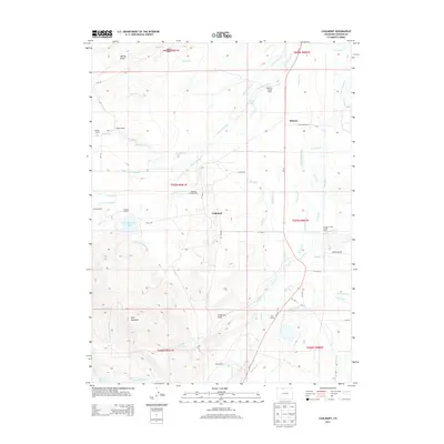
2013 Map of Coalmont
USGS Topo · Published 2013About this map
The settlement of Coalmont and the smaller locality of Hebron anchor this high-altitude landscape in Jackson County, Colorado. Situated in a region defined by complex water management, the map reveals an extensive network of irrigation infrastructure designed to sustain ranching operations. Significant works such as the Darby Ditch, Little Grizzly Ditch, and Grizzly Extension Ditch crisscross the terrain, drawing from Little Grizzly Cr and Grizzly Cr. This elaborate system of ditches and drains supports numerous historic family-named properties, including the Grizzly Cattle Ranch, Wamsley Cattle Ranch, and Stelbar Grizzly Creek Ranch. To the southwest, the topography rises toward Pole Mountain, where Pole Mountain Lake and Mexican Reservoir mark the transition into more elevated, drainage-fed basins. The presence of features like Baker Draw and Anderson Draw further illustrates the natural erosion patterns that define this working ranching corridor.
Find a feature on this map
61 named features on this map. Tap any name to fly to it.
Don’t see what you’re looking for? This feature index may not catch every label — zoom into the map to look around manually.
Map Details
Editions of this 2013 Coalmont Map
This is the sole edition of this map. No revisions or reprints were ever made.
Other maps of this area

1911 · Hahns Peak
USGS Topo · 1:125,000

1913 · Hahns Peak
USGS Topo · 1:125,000

1954 · Craig
USGS Topo · 1:250,000

1955 · Pitchpine Mountain
USGS Topo · 1:24,000

1955 · Teal Lake
USGS Topo · 1:24,000

1955 · Delaney Butte
USGS Topo · 1:24,000

1955 · Coalmont
USGS Topo · 1:24,000

1955 · Walden
USGS Topo · 1:24,000

1955 · Mac Farlane Reservoir
USGS Topo · 1:24,000

1955 · Mount Ethel
USGS Topo · 1:62,500