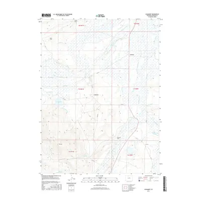
2016 Map of Coalmont
USGS Topo · Published 2016About this map
Coalmont and Hebron anchor this high-altitude landscape in Jackson County, where an intricate web of irrigation infrastructure defines the local geography. The map reveals a complex network of water management, featuring numerous named canals like the Grizzly Extension Ditch and the Marr Ditch Number 1 that draw from Little Grizzly Cr and other mountain streams. This reliance on hydraulic engineering is a hallmark of Colorado's ranching history, as seen in the sprawling wetlands and ditches that crisscross the terrain between Pole Mtn and the valley floor. Researchers can trace historic land divisions through the Public Land Survey System grids, which encompass several townships including t7n r81w. Significant water bodies such as Petry Lake, Fuller Reservoir, and Pole Mountain Lake serve as vital landmarks within this hydraulic system, illustrating how water rights and movement shaped the development of these North Park communities.
Find a feature on this map
46 named features on this map. Tap any name to fly to it.
Don’t see what you’re looking for? This feature index may not catch every label — zoom into the map to look around manually.
Map Details
Editions of this 2016 Coalmont Map
This is the sole edition of this map. No revisions or reprints were ever made.
Other maps of this area

1911 · Hahns Peak
USGS Topo · 1:125,000

1913 · Hahns Peak
USGS Topo · 1:125,000

1954 · Craig
USGS Topo · 1:250,000

1955 · Pitchpine Mountain
USGS Topo · 1:24,000

1955 · Teal Lake
USGS Topo · 1:24,000

1955 · Delaney Butte
USGS Topo · 1:24,000

1955 · Coalmont
USGS Topo · 1:24,000

1955 · Walden
USGS Topo · 1:24,000

1955 · Mac Farlane Reservoir
USGS Topo · 1:24,000

1955 · Mount Ethel
USGS Topo · 1:62,500