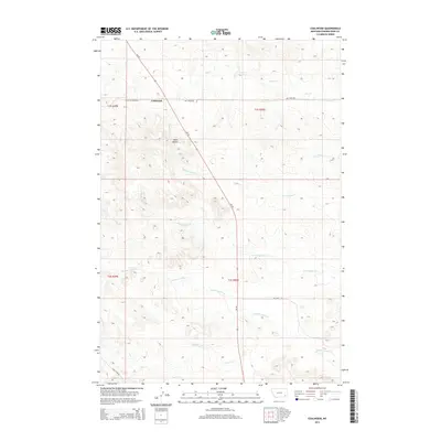
2014 Map of Coalwood
USGS Topo · Published 2014About this map
Coalwood serves as the central focal point of this Eastern Montana landscape, situated at the junction of MT 59 and Hay Creek Rd. The terrain is defined by a dense network of intermittent drainage systems, notably Double Corral Cr and Lost Soldier Cr, which carve through the high plains. High ground is marked by prominent landforms such as Twin Buttes, providing a clear view of the surrounding rangeland.
Find a feature on this map
18 named features on this map. Tap any name to fly to it.
Don’t see what you’re looking for? This feature index may not catch every label — zoom into the map to look around manually.
Map Details
Editions of this 2014 Coalwood Map
This is the sole edition of this map. No revisions or reprints were ever made.
Other maps of this area

1954 · Ekalaka
USGS Topo · 1:250,000

1956 · Ekalaka
USGS Topo · 1:250,000

1958 · Ekalaka
USGS Topo · 1:250,000

1965 · Ekalaka
USGS Topo · 1:250,000

1973 · Olive
USGS Topo · 1:24,000
1973 · Witcher Reservoir
USGS Topo · 1:24,000

1973 · Moonlight Creek
USGS Topo · 1:24,000

1973 · Box Elder Creek
USGS Topo · 1:24,000

1973 · Coalwood
USGS Topo · 1:24,000
1973 · Divide School
USGS Topo · 1:24,000