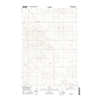
2017 Map of Coalwood
USGS Topo · Published 2017About this map
Coalwood serves as the central anchor for this portion of Powder River County, situated where a network of rural roads such as Lockwood Rd and Hay Creek Rd converge. The landscape is defined by its drainage basins, with several seasonal and perennial waterways branching across the terrain, including Mud Spring Cr and Lost Soldier Cr. To the southwest of the main settlement, the distinctive rising topography of Twin Buttes stands out against the surrounding drainages of Double Corral Cr and Lake Creek. This survey details the complex system of cattle roads and land partitions typical of Montana's high plains, tracing the path of Soldier Creek Rd and Lake Creek Rd as they navigate the ridges between the numerous creek beds.
Find a feature on this map
21 named features on this map. Tap any name to fly to it.
Don’t see what you’re looking for? This feature index may not catch every label — zoom into the map to look around manually.
Map Details
Editions of this 2017 Coalwood Map
This is the sole edition of this map. No revisions or reprints were ever made.
Other maps of this area

1954 · Ekalaka
USGS Topo · 1:250,000

1956 · Ekalaka
USGS Topo · 1:250,000

1958 · Ekalaka
USGS Topo · 1:250,000

1965 · Ekalaka
USGS Topo · 1:250,000

1973 · Olive
USGS Topo · 1:24,000
1973 · Witcher Reservoir
USGS Topo · 1:24,000

1973 · Moonlight Creek
USGS Topo · 1:24,000

1973 · Box Elder Creek
USGS Topo · 1:24,000

1973 · Coalwood
USGS Topo · 1:24,000
1973 · Divide School
USGS Topo · 1:24,000