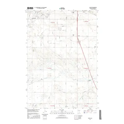
2016 Map of Coates
USGS Topo · Published 2016About this map
Rosemount and the surrounding Dakota County countryside are depicted here during a period of modern suburban transition and agricultural persistence. The landscape is defined by a dense network of residential streets and arterial roads like Co Rd 42 and Coates Blvd, which cut through the undulating terrain south of the Twin Cities. In the eastern portion of the sheet, the small settlement of Coates sits adjacent to Turkey Track Airport, while the Vermillion River meanders through the southern half of the quadrangle near Empire. For genealogists and local historians, the map identifies several significant burial sites, including Saint Johns Cem, Saint Augustine Cem, and Emmanuel Cem. The transition from the more developed blocks of Rosemount to the wetlands along the river branches illustrates the evolving land use patterns of the early twenty-first century.
Find a feature on this map
88 named features on this map. Tap any name to fly to it.
Don’t see what you’re looking for? This feature index may not catch every label — zoom into the map to look around manually.
Map Details
Editions of this 2016 Coates Map
This is the sole edition of this map. No revisions or reprints were ever made.
Other maps of this area

1896 · St. Paul
USGS Topo · 1:62,500

1946 · Hudson
USGS Topo · 1:62,500

1949 · Hudson
USGS Topo · 1:62,500

1950 · St Paul Park
USGS Topo · 1:24,000

1951 · St Paul Park
USGS Topo · 1:24,000

1951 · Inver Grove
USGS Topo · 1:24,000

1951 · St. Paul SW
USGS Topo · 1:24,000

1951 · St. Paul
USGS Topo · 1:62,500

1953 · Saint Paul
USGS Topo · 1:250,000

1957 · Farmington
USGS Topo · 1:62,500