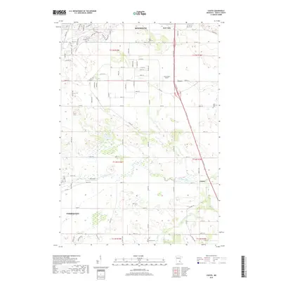
2019 Map of Coates
USGS Topo · Published 2019About this map
Rosemount and Farmington anchor the northern and southern reaches of this Dakota County landscape, where the agricultural grid is increasingly intersected by residential development and modern thoroughfares. The central portion of the sheet is defined by the small settlements of Coates and Rich Valley, and the rural community of Empire to the southeast. Transport and local aviation are prominent features, with Turkey Track Airport and Hall Airport situated among the farmsteads. The Vermillion River and its tributary, the S Br Vermillion River, carve natural drainage paths through the township sections. Genealogists will find several historical markers of the area's early settlers, including Saint Johns Cem near Rosemount, Saint Augustine Cem on the eastern edge, and Emmanuel Cem at the southern boundary. The map captures a transition as longtime family lands and sections like T114N R19W are reorganized into suburban street networks such as Connemara Trl and Ailesbury Ave.
Find a feature on this map
93 named features on this map. Tap any name to fly to it.
Don’t see what you’re looking for? This feature index may not catch every label — zoom into the map to look around manually.
Map Details
Editions of this 2019 Coates Map
This is the sole edition of this map. No revisions or reprints were ever made.
Other maps of this area

1896 · St. Paul
USGS Topo · 1:62,500

1946 · Hudson
USGS Topo · 1:62,500

1949 · Hudson
USGS Topo · 1:62,500

1950 · St Paul Park
USGS Topo · 1:24,000

1951 · St Paul Park
USGS Topo · 1:24,000

1951 · Inver Grove
USGS Topo · 1:24,000

1951 · St. Paul SW
USGS Topo · 1:24,000

1951 · St. Paul
USGS Topo · 1:62,500

1953 · Saint Paul
USGS Topo · 1:250,000

1957 · Farmington
USGS Topo · 1:62,500