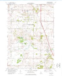
1974 Map of Coates
USGS Topo · Published 1976About this map
Rosemount Research Center and the extensive grounds of the University of Minnesota dominate the central landscape of this Dakota County survey. The area exhibits a transition from academic and research facilities to the rural reaches of Empire and the village of Coates. The Vermillion River and its South Branch wind through the southern half of the quadrangle, punctuated by numerous gravel pits and quarries that indicate the region's active industrial excavations during the mid-1970s.
Find a feature on this map
51 named features on this map. Tap any name to fly to it.
Don’t see what you’re looking for? This feature index may not catch every label — zoom into the map to look around manually.
Map Details
Editions of this 1974 Coates Map
3 editions found
Other maps of this area

1896 · St. Paul
USGS Topo · 1:62,500

1946 · Hudson
USGS Topo · 1:62,500

1949 · Hudson
USGS Topo · 1:62,500

1950 · St Paul Park
USGS Topo · 1:24,000

1951 · St Paul Park
USGS Topo · 1:24,000

1951 · Inver Grove
USGS Topo · 1:24,000

1951 · St. Paul SW
USGS Topo · 1:24,000

1951 · St. Paul
USGS Topo · 1:62,500

1953 · Saint Paul
USGS Topo · 1:250,000

1957 · Farmington
USGS Topo · 1:62,500