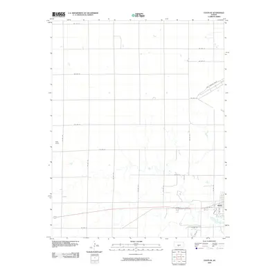
2009 Map of Coats NE
USGS Topo · Published 2009About this map
Pratt serves as the primary hub on this High Plains landscape, situated at the confluence of several regional transportation arteries. The area is defined by its rectilinear grid of section-line roads, such as NW 70th Ave and NW 70th St, which frame the agricultural reaches surrounding the town center. The industrial and logistical significance of the region is anchored by the Pratt Municipal Airport, located northeast of the main settlement. Topographically, the terrain is subtly varied, punctuated by Pilot Knob in the western portion of the quadrangle. Residential expansion is evident in the layout of streets like Lakeview Dr and E Ridge Rd, reflecting the modern development patterns of this Pratt County seat as it appeared in the late 2000s.
Find a feature on this map
26 named features on this map. Tap any name to fly to it.
Don’t see what you’re looking for? This feature index may not catch every label — zoom into the map to look around manually.
Map Details
Editions of this 2009 Coats NE Map
This is the sole edition of this map. No revisions or reprints were ever made.
Other maps of this area

1892 · Pratt
USGS Topo · 1:125,000

1894 · Pratt
USGS Topo · 1:125,000

1955 · Pratt
USGS Topo · 1:250,000

1959 · Pratt
USGS Topo · 1:250,000

1968 · Pratt SW
USGS Topo · 1:24,000

1968 · Pratt
USGS Topo · 1:24,000

1968 · Cullison
USGS Topo · 1:24,000

1968 · Coats
USGS Topo · 1:24,000

1968 · Coats NE
USGS Topo · 1:24,000
1968 · Croft
USGS Topo · 1:24,000