
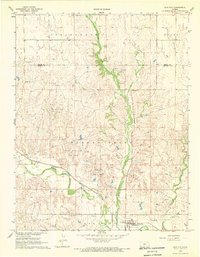
1968 Map of Coats
USGS Topo · Published 1970About this map
The town of Coats serves as the focal point of this Pratt County landscape, situated along the Atchison Topeka and Santa Fe railroad line. The map illustrates a late-1960s agricultural and industrial environment where several regional watercourses converge, including the South Fork Ninnescah River, Sand Creek, and the East Branch. Local industry is evidenced by numerous resource extraction sites such as an active Silica Pit, multiple Oil Well locations, and gravel pits scattered across the townships of Richland, Center, Grant, and Elm. For genealogical research, the Coats Cem is clearly marked just north of the village. The presence of a Gaging Station on the river and a complex network of branching creeks like North Branch Elm Cr reveals the hydrological importance of this plains region.
Find a feature on this map
16 named features on this map. Tap any name to fly to it.
Don’t see what you’re looking for? This feature index may not catch every label — zoom into the map to look around manually.
Map Details
Editions of this 1968 Coats Map
This is the sole edition of this map. No revisions or reprints were ever made.
Other maps of this area

1891 · Medicine Lodge
USGS Topo · 1:125,000

1892 · Pratt
USGS Topo · 1:125,000

1893 · Medicine Lodge
USGS Topo · 1:125,000

1894 · Pratt
USGS Topo · 1:125,000

1955 · Pratt
USGS Topo · 1:250,000

1959 · Pratt
USGS Topo · 1:250,000

1968 · Pratt SW
USGS Topo · 1:24,000
1968 · Sun City
USGS Topo · 1:24,000

1968 · Pratt
USGS Topo · 1:24,000

1968 · Cullison
USGS Topo · 1:24,000