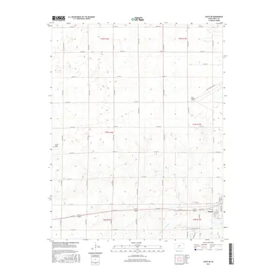
2016 Map of Coats NE
USGS Topo · Published 2016About this map
The southern portion of the city of Pratt serves as the primary urban center for this Kansas landscape, situated just north of the S Fork Ninnescah River. The terrain is defined by a grid of rural avenues and streets that segment the plains, leading toward the Pratt Municipal Airport and Pratt Regional Airport in the northeast. One of the few prominent topographic variations in this largely flat region is Pilot Knob, located on the western edge of the survey area. The mapping reflects the transition from the structured street plan of the town into the surrounding agricultural sections, highlighting how the local river system and aviation facilities anchor the regional economy and transportation network.
Find a feature on this map
46 named features on this map. Tap any name to fly to it.
Don’t see what you’re looking for? This feature index may not catch every label — zoom into the map to look around manually.
Map Details
Editions of this 2016 Coats NE Map
This is the sole edition of this map. No revisions or reprints were ever made.
Other maps of this area

1892 · Pratt
USGS Topo · 1:125,000

1894 · Pratt
USGS Topo · 1:125,000

1955 · Pratt
USGS Topo · 1:250,000

1959 · Pratt
USGS Topo · 1:250,000

1968 · Pratt SW
USGS Topo · 1:24,000

1968 · Pratt
USGS Topo · 1:24,000

1968 · Cullison
USGS Topo · 1:24,000

1968 · Coats
USGS Topo · 1:24,000

1968 · Coats NE
USGS Topo · 1:24,000
1968 · Croft
USGS Topo · 1:24,000