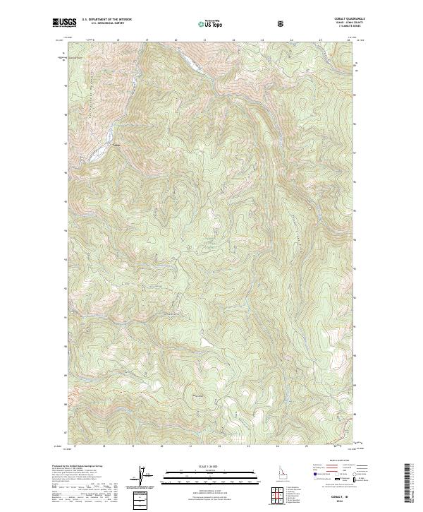
2024 Map of Cobalt
USGS Topo · Published 2024About this map
Cobalt lies at the heart of this Idaho landscape, situated within the high terrain of the Yellowjacket Mountains and surrounded by the Salmon National Forest. The map documents a rugged network of watercourses and ridges, defined by the drainage of Panther Creek and Deep Creek. Historical movement through this high country is evidenced by the Thunder Mountain Historic Trl, which winds through the southern sections near Swan Peak. Forest service routes like Nat For Dev Rd 100 and Deep Creek Rd provide the primary access through these steep valleys. The naming of features like Copper Creek, Fawn Creek, and Pepper Creek Ridge reflects the long-standing mining and natural history of Lemhi County, where isolated settlements once supported regional industry among the peaks.
Find a feature on this map
29 named features on this map. Tap any name to fly to it.
Don’t see what you’re looking for? This feature index may not catch every label — zoom into the map to look around manually.
Map Details
Editions of this 2024 Cobalt Map
This is the sole edition of this map. No revisions or reprints were ever made.
Other maps of this area

1950 · Blackbird Mtn
USGS Topo · 1:62,500

1950 · Leesburg
USGS Topo · 1:62,500

1951 · Leesburg
USGS Topo · 1:62,500

1951 · Blackbird Mtn
USGS Topo · 1:62,500

1956 · Elk City
USGS Topo · 1:250,000

1957 · Challis
USGS Topo · 1:250,000

1960 · Elk City
USGS Topo · 1:250,000

1960 · Challis
USGS Topo · 1:250,000
1962 · Degan Mtn
USGS Topo · 1:24,000

1963 · Challis
USGS Topo · 1:250,000