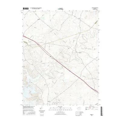
2016 Map of Cobb
USGS Topo · Published 2016About this map
Muddy Fork Little River meanders across this Trigg County landscape, defining the topography between the settlements of Cobb and Wallonia. The terrain reflects a dense network of family-held lands and rural heritage, marked by numerous small burial sites such as Merrick Cem, Dunning Cem, and Wall Cem. In the south, the city of Cadiz sits near the reach of Lake Barkley, while the northern portion of the map traces the Caldwell and Trigg county line through Hopson. The map reveals a transition from the agricultural uplands drained by Kenady Cr and Millwood Cr to the more developed corridors surrounding the regional hub of Cadiz, offering a detailed look at the rural road network including E Adams Mill Rd and Blue Springs Rd.
Find a feature on this map
71 named features on this map. Tap any name to fly to it.
Don’t see what you’re looking for? This feature index may not catch every label — zoom into the map to look around manually.
Map Details
Editions of this 2016 Cobb Map
This is the sole edition of this map. No revisions or reprints were ever made.
Other maps of this area

1908 · Princeton
USGS Topo · 1:62,500

1909 · Dawson Springs
USGS Topo · 1:48,000

1910 · Princeton
USGS Topo · 1:62,500

1911 · Dawson Springs
USGS Topo · 1:62,500

1950 · Caledonia
USGS Topo · 1:24,000

1951 · Caledonia
USGS Topo · 1:24,000

1953 · Canton
USGS Topo · 1:24,000

1953 · Gracey
USGS Topo · 1:24,000

1953 · Cobb
USGS Topo · 1:24,000

1953 · Dawson Springs SW
USGS Topo · 1:24,000