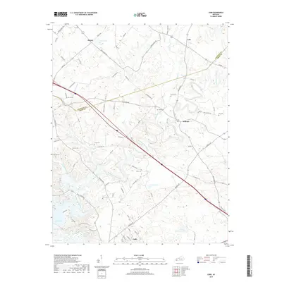
2019 Map of Cobb
USGS Topo · Published 2019About this map
Muddy Fork Little River meanders across this landscape, defining the rural character of northern Trigg Co and southern Caldwell County. The small communities of Cobb, Hopson, and Wallonia serve as historic anchors in a terrain dominated by agricultural reaches and scattered family burial grounds. Numerous family-named cemeteries, including Larkins Cem, Hanberry Cem, and Merrick Cem, provide valuable landmarks for genealogists tracing local lineage in this corner of Kentucky. In the southwest, the topography gives way to the modern shoreline of Lake Barkley, where the Little River enters the impoundment near Cadiz. The network of local roads such as Hopson Store Rd and Wall Cemetery Rd connects these longstanding settlements, reflecting a distribution of homesteads that has remained relatively consistent over decades.
Find a feature on this map
74 named features on this map. Tap any name to fly to it.
Don’t see what you’re looking for? This feature index may not catch every label — zoom into the map to look around manually.
Map Details
Editions of this 2019 Cobb Map
This is the sole edition of this map. No revisions or reprints were ever made.
Other maps of this area

1908 · Princeton
USGS Topo · 1:62,500

1909 · Dawson Springs
USGS Topo · 1:48,000

1910 · Princeton
USGS Topo · 1:62,500

1911 · Dawson Springs
USGS Topo · 1:62,500

1950 · Caledonia
USGS Topo · 1:24,000

1951 · Caledonia
USGS Topo · 1:24,000

1953 · Canton
USGS Topo · 1:24,000

1953 · Gracey
USGS Topo · 1:24,000

1953 · Cobb
USGS Topo · 1:24,000

1953 · Dawson Springs SW
USGS Topo · 1:24,000