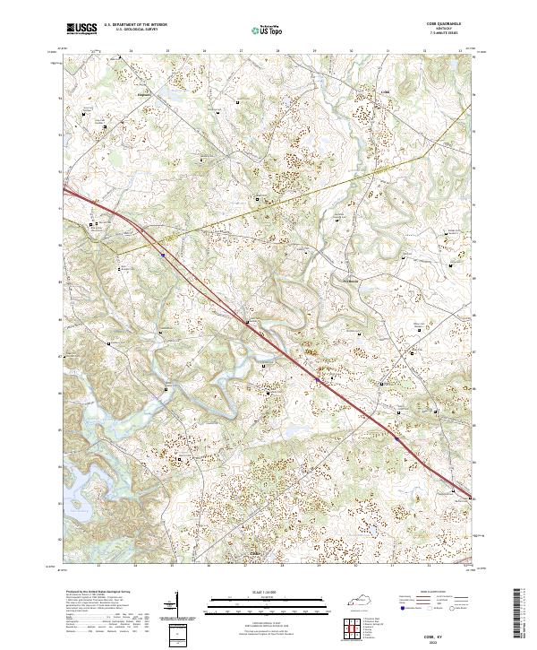
2022 Map of Cobb
USGS Topo · Published 2022About this map
The Muddy Fork Little River meanders across a landscape defined by its deep genealogical roots and small rural crossroads. Located along the boundary of Caldwell Co and Trigg Co, the area is densely marked with family burial grounds, including the Sugar Jim Mitchell Cem, Dyer - Brandon Cem, and the Larkins Cem. These small cemeteries are often the only remaining physical markers of the generations that farmed these hills.
Find a feature on this map
106 named features on this map. Tap any name to fly to it.
Don’t see what you’re looking for? This feature index may not catch every label — zoom into the map to look around manually.
Map Details
Editions of this 2022 Cobb Map
This is the sole edition of this map. No revisions or reprints were ever made.
Other maps of this area

1908 · Princeton
USGS Topo · 1:62,500

1909 · Dawson Springs
USGS Topo · 1:48,000

1910 · Princeton
USGS Topo · 1:62,500

1911 · Dawson Springs
USGS Topo · 1:62,500

1950 · Caledonia
USGS Topo · 1:24,000

1951 · Caledonia
USGS Topo · 1:24,000

1953 · Canton
USGS Topo · 1:24,000

1953 · Gracey
USGS Topo · 1:24,000

1953 · Cobb
USGS Topo · 1:24,000

1953 · Dawson Springs SW
USGS Topo · 1:24,000