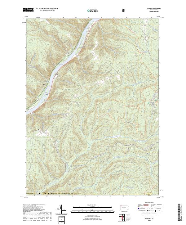
2023 Map of Cobham
USGS Topo · Published 2023About this map
Allegheny National Forest dominates this section of the Allegheny River valley, where the waterway winds past distinctive islands like Stewards Island and Fuellhart Island. The landscape is defined by the steep elevation changes from Davy Hill down to the riverbanks, where the small settlements of Cobham and Magee sit along the S R 3005 corridor. This modern survey illustrates the conservation-focused land use of the region, specifically through the Hickory Creek Wilderness and the Allegheny Islands Wilderness, which protect the riparian ecosystems and mature forests of the area.
Find a feature on this map
65 named features on this map. Tap any name to fly to it.
Don’t see what you’re looking for? This feature index may not catch every label — zoom into the map to look around manually.
Map Details
Editions of this 2023 Cobham Map
This is the sole edition of this map. No revisions or reprints were ever made.
Other maps of this area

1906 · Warren
USGS Topo · 1:62,500

1907 · Warren
USGS Topo · 1:62,500

1908 · Warren
USGS Topo · 1:62,500

1926 · Youngsville
USGS Topo · 1:62,500

1927 · Tidioute
USGS Topo · 1:48,000

1929 · Youngsville
USGS Topo · 1:62,500

1930 · Tidioute
USGS Topo · 1:62,500

1935 · Sheffield
USGS Topo · 1:48,000

1941 · Sheffield
USGS Topo · 1:62,500

1943 · Youngsville
USGS Topo · 1:62,500
Featured Places
- Deerfield Township, PA
- Limestone Township, PA
- Watson Township, PA
- Queen, Hickory Township
- Hearts Content, PA