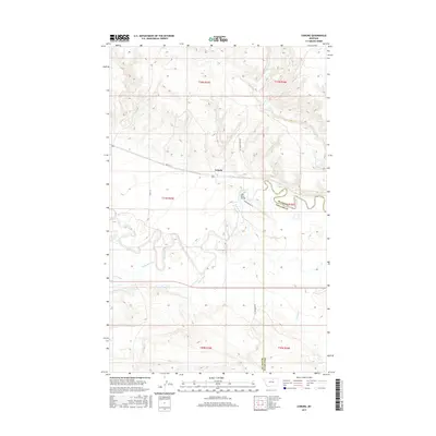
2017 Map of Coburg
USGS Topo · Published 2017About this map
Coburg serves as the focal point of this rural prairie landscape, situated near the boundary where Blaine Co and Phillips Co meet. The area is defined by the winding course of the Milk River, which meanders across the eastern half of the map, crossed by the Milk River Bridge. This region illustrates the vital relationship between water management and agriculture in northern Montana, showcased by the Main Canal and its path across the plains.
Find a feature on this map
20 named features on this map. Tap any name to fly to it.
Don’t see what you’re looking for? This feature index may not catch every label — zoom into the map to look around manually.
Map Details
Editions of this 2017 Coburg Map
This is the sole edition of this map. No revisions or reprints were ever made.
Other maps of this area

1903 · Wayne Creek
USGS Topo · 1:62,500

1905 · Wayne Creek
USGS Topo · 1:62,500

1913 · Cherry Ridge
USGS Topo · 1:125,000

1920 · Avery
USGS Topo · 1:125,000

1953 · Havre
USGS Topo · 1:250,000

1957 · Havre
USGS Topo · 1:250,000

1958 · Havre
USGS Topo · 1:250,000

1964 · Wayne Creek SE
USGS Topo · 1:24,000

1964 · Coburg
USGS Topo · 1:24,000

1964 · Coburg SE
USGS Topo · 1:24,000