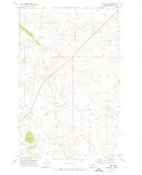
1971 Map of Coburn Butte
USGS Topo · Published 1974About this map
The Fort Belknap Indian Reservation Boundary cuts through this north-central Montana landscape, marking a clear divide in the prairie terrain of Phillips County. This 1971 survey highlights the irrigation and ranching infrastructure critical to the region, including the winding path of the Coburn Ditch and the established Matador Ranch. The topographic detail reveals the prominence of Coburn Butte and the Judith River Ridge, which overlook a complex network of waterways like Little Warm Creek and Beaver Creek. The presence of Baker Cr and Bear Gulch indicates the drainage patterns that have shaped these grasslands for generations. Together, these features document a period of managed ranchlands and significant tribal boundaries during the early 1970s.
Find a feature on this map
11 named features on this map. Tap any name to fly to it.
Don’t see what you’re looking for? This feature index may not catch every label — zoom into the map to look around manually.
Map Details
Editions of this 1971 Coburn Butte Map
This is the sole edition of this map. No revisions or reprints were ever made.
Other maps of this area

1953 · Havre
USGS Topo · 1:250,000

1954 · Lewistown
USGS Topo · 1:250,000

1957 · Havre
USGS Topo · 1:250,000

1958 · Havre
USGS Topo · 1:250,000

1959 · Lewistown
USGS Topo · 1:250,000

1965 · Veseth Reservoir
USGS Topo · 1:24,000

1965 · Phillips
USGS Topo · 1:24,000

1965 · Dry Fork Ridge
USGS Topo · 1:24,000

1971 · Bear Mountain
USGS Topo · 1:24,000

1971 · Robinson School
USGS Topo · 1:24,000