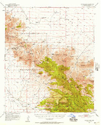
1950 Map of Cochise Head
USGS Topo · Published 1957About this map
Old Fort Bowie (Ruins) sits at the strategic bottleneck of Apache Pass, marking a landscape defined by 19th-century military history and early ranching. This 1950s survey shows the Fort Bowie Military Reservation Boundary (Aban'd) spanning the rugged height of the Dos Cabezas Mountains, where miners sought fortune at the Silverstrike Mine and Goodwin. The transition from frontier conflict to conservation is evident in the southern half of the map, which includes the northern reaches of the Chiricahua National Monument.
Find a feature on this map
90 named features on this map. Tap any name to fly to it.
Don’t see what you’re looking for? This feature index may not catch every label — zoom into the map to look around manually.
Map Details
Editions of this 1950 Cochise Head Map
3 editions found

Other maps of this area

1916 · Pearce
USGS Topo · 1:125,000

1917 · San Simon
USGS Topo · 1:125,000

1917 · Chiricahua
USGS Topo · 1:125,000

1919 · Chiricahua
USGS Topo · 1:125,000

1922 · Willcox
USGS Topo · 1:125,000

1926 · Light
USGS Topo · 1:62,500

1926 · Cochise Head
USGS Topo · 1:62,500

1926 · Rodeo
USGS Topo · 1:62,500

1926 · Rucker
USGS Topo · 1:62,500

1926 · Orange Butte
USGS Topo · 1:62,500