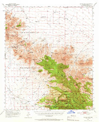
1950 Map of Cochise Head
USGS Topo · Published 1966About this map
Old Fort Bowie (Ruins) anchors this high-desert landscape within the Fort Bowie Military Reservation Boundary (Aban'd), marking a site of deep historical significance at Apache Pass. The topography transitions from the eastern edge of the Sulphur Springs Valley into the dramatic formations of the Chiricahua National Monument, where the profile of Cochise Head dominates the skyline.
Find a feature on this map
98 named features on this map. Tap any name to fly to it.
Don’t see what you’re looking for? This feature index may not catch every label — zoom into the map to look around manually.
Map Details
Editions of this 1950 Cochise Head Map
3 editions found

Other maps of this area

1916 · Pearce
USGS Topo · 1:125,000

1917 · San Simon
USGS Topo · 1:125,000

1917 · Chiricahua
USGS Topo · 1:125,000

1919 · Chiricahua
USGS Topo · 1:125,000

1922 · Willcox
USGS Topo · 1:125,000

1926 · Light
USGS Topo · 1:62,500

1926 · Cochise Head
USGS Topo · 1:62,500

1926 · Rodeo
USGS Topo · 1:62,500

1926 · Rucker
USGS Topo · 1:62,500

1926 · Orange Butte
USGS Topo · 1:62,500