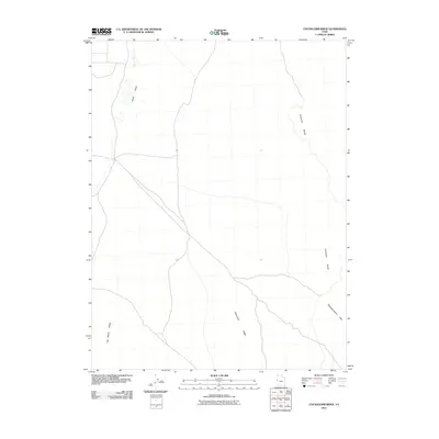
2011 Map of Cockscomb Ridge
USGS Topo · Published 2011About this map
Snake Valley serves as the focal point of this arid Great Basin landscape, where the flat basin floor meets the uplifted formations of the Salt Marsh Range and Confusion Range. The 2011 survey by the U.S. Geological Survey reveals a network of roads and trails traversing a region defined by its distinct geological names. The namesake Cockscomb Ridge angles through the central portion of the map, while the Disappointment Hills occupy the eastern edge, marking the transition into the higher elevation of the surrounding ranges. This map details the isolated infrastructure required for navigating the high desert, including several unimproved roads that follow the natural contours of the valley and its surrounding ridges.
Find a feature on this map
5 named features on this map. Tap any name to fly to it.
Don’t see what you’re looking for? This feature index may not catch every label — zoom into the map to look around manually.
Map Details
Editions of this 2011 Cockscomb Ridge Map
This is the sole edition of this map. No revisions or reprints were ever made.
Other maps of this area

1908 · Fish Springs
USGS Topo · 1:250,000

1910 · Fish Springs
USGS Topo · 1:250,000

1953 · Delta
USGS Topo · 1:250,000

1958 · Delta
USGS Topo · 1:250,000

1959 · Cowboy Pass
USGS Topo · 1:62,500

1960 · Granite Mountain
USGS Topo · 1:62,500

1960 · Gandy
USGS Topo · 1:62,500

1961 · Trout Creek
USGS Topo · 1:62,500

1962 · Delta
USGS Topo · 1:250,000
1979 · Fish Springs
USGS Topo · 1:100,000