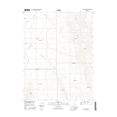
2014 Map of Cockscomb Ridge
USGS Topo · Published 2014About this map
Cockscomb Ridge dominates the center of this remote desert landscape along the border of Juab and Millard counties. The western portion of the map is defined by the broad expanse of Snake Valley, where a network of unpaved ranch roads like Miller Ranch Rd and the whimsically named Humpty Dumpty Left Rd cross the basin floor. This area provides a clear view of the transition between the valley floor and the dramatic uplifts of the Confusion Range to the east.
Find a feature on this map
16 named features on this map. Tap any name to fly to it.
Don’t see what you’re looking for? This feature index may not catch every label — zoom into the map to look around manually.
Map Details
Editions of this 2014 Cockscomb Ridge Map
This is the sole edition of this map. No revisions or reprints were ever made.
Other maps of this area

1908 · Fish Springs
USGS Topo · 1:250,000

1910 · Fish Springs
USGS Topo · 1:250,000

1953 · Delta
USGS Topo · 1:250,000

1958 · Delta
USGS Topo · 1:250,000

1959 · Cowboy Pass
USGS Topo · 1:62,500

1960 · Granite Mountain
USGS Topo · 1:62,500

1960 · Gandy
USGS Topo · 1:62,500

1961 · Trout Creek
USGS Topo · 1:62,500

1962 · Delta
USGS Topo · 1:250,000
1979 · Fish Springs
USGS Topo · 1:100,000